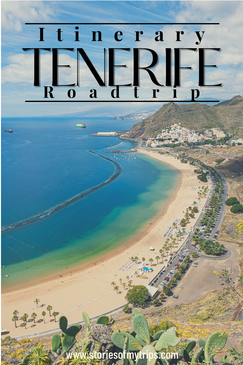
Tenerife is the largest of the Canary Islands, and of course, it has a lot to see and do. To plan the route through Tenerife more easily, I decided to divide the island into 5 sections. The name of the sections should not be taken literally, they are only a rough guide to plan the trips. Also, Tenerife has many microclimates, so each of these sections has slightly different weather. In the south it is hotter, the north is colder, Anaga is quite humid and foggy, and so on. So it is better to be prepared for these changes in temperature.
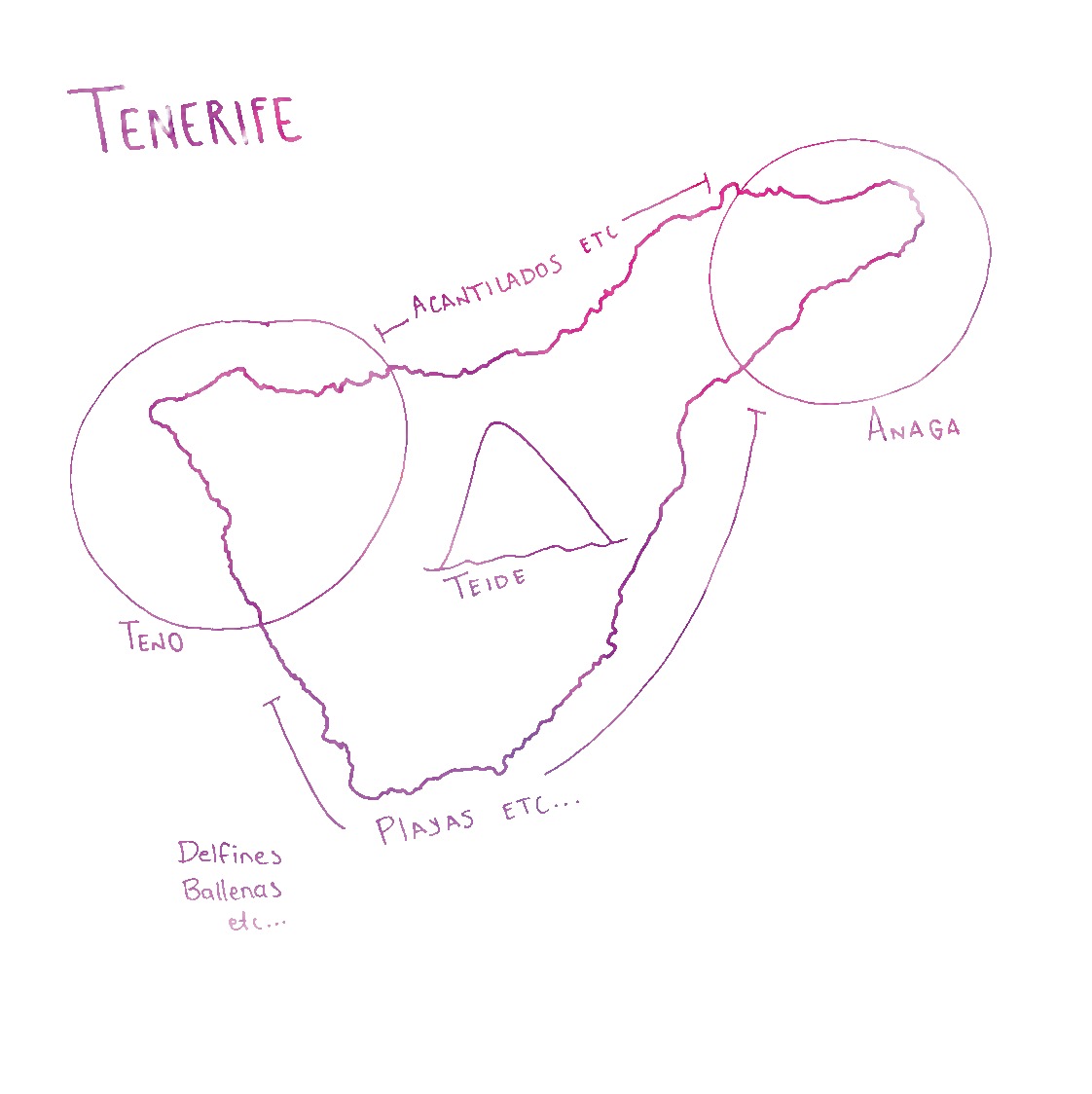
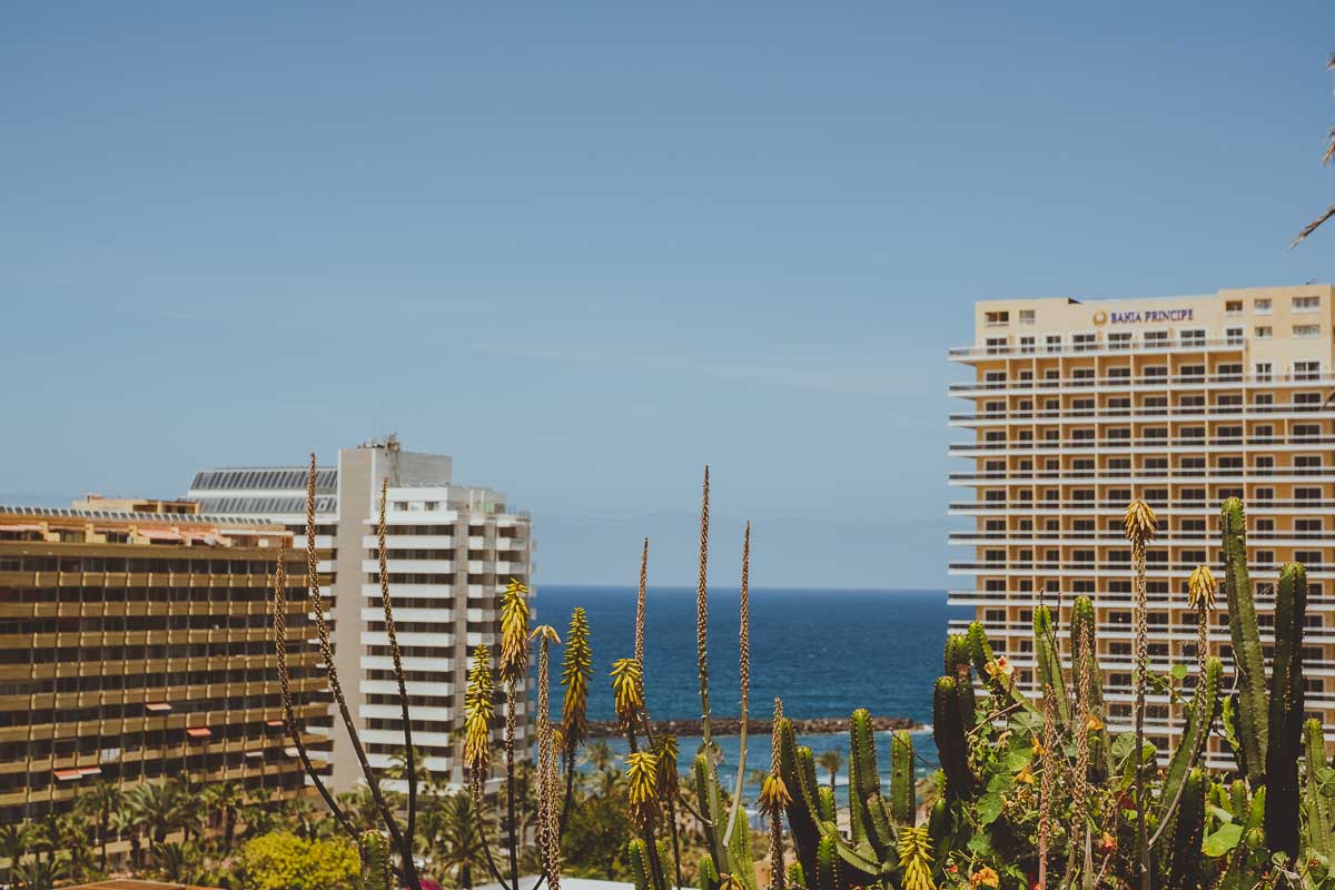
South: The south is the most touristic part of the island, here are most of the resorts, the cities are more artificial, but the weather is the warmest on the island, it has interesting beaches and it is the best place to do activities in the water, such as whale watching, snorkeling, diving, kayaking etc.
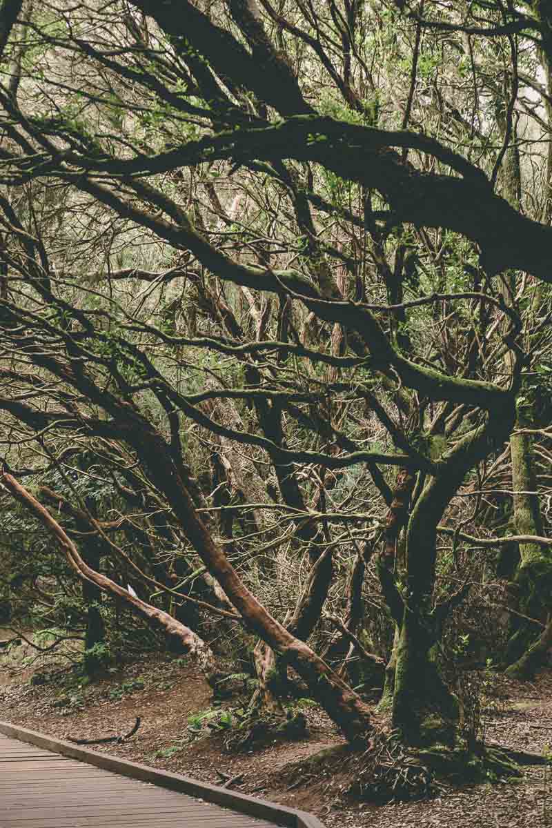
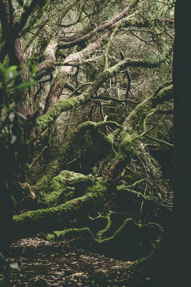
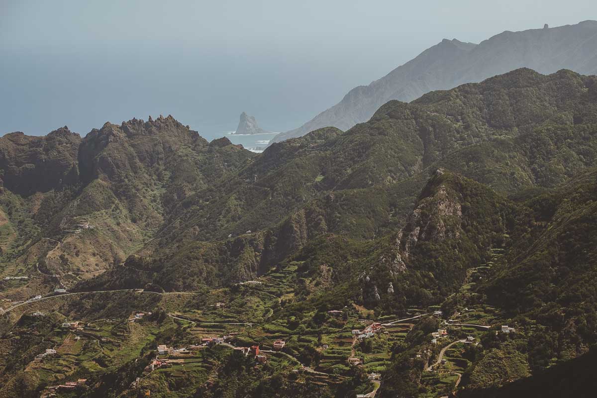
Eastern Point: Anaga Rural Park is located on the east point of the island. It has the most spectacular views and landscapes of the island: pointed mountains, ravines, viewpoints and laurel forests, wild beaches, and mountain villages. This is the most humid place on the island, but also the most beautiful.
North: In the north is where we find the best landscapes, mountains, cliffs, it also has a more local atmosphere, with very interesting towns and cities. The weather is cooler than in the south.
Western Point: Here we find the Teno, this is a mountainous massif surrounded by the sea, where you can do different hiking routes to explore its valleys and mountains. In addition, you can visit traditional towns that preserve the oldest customs of the island.
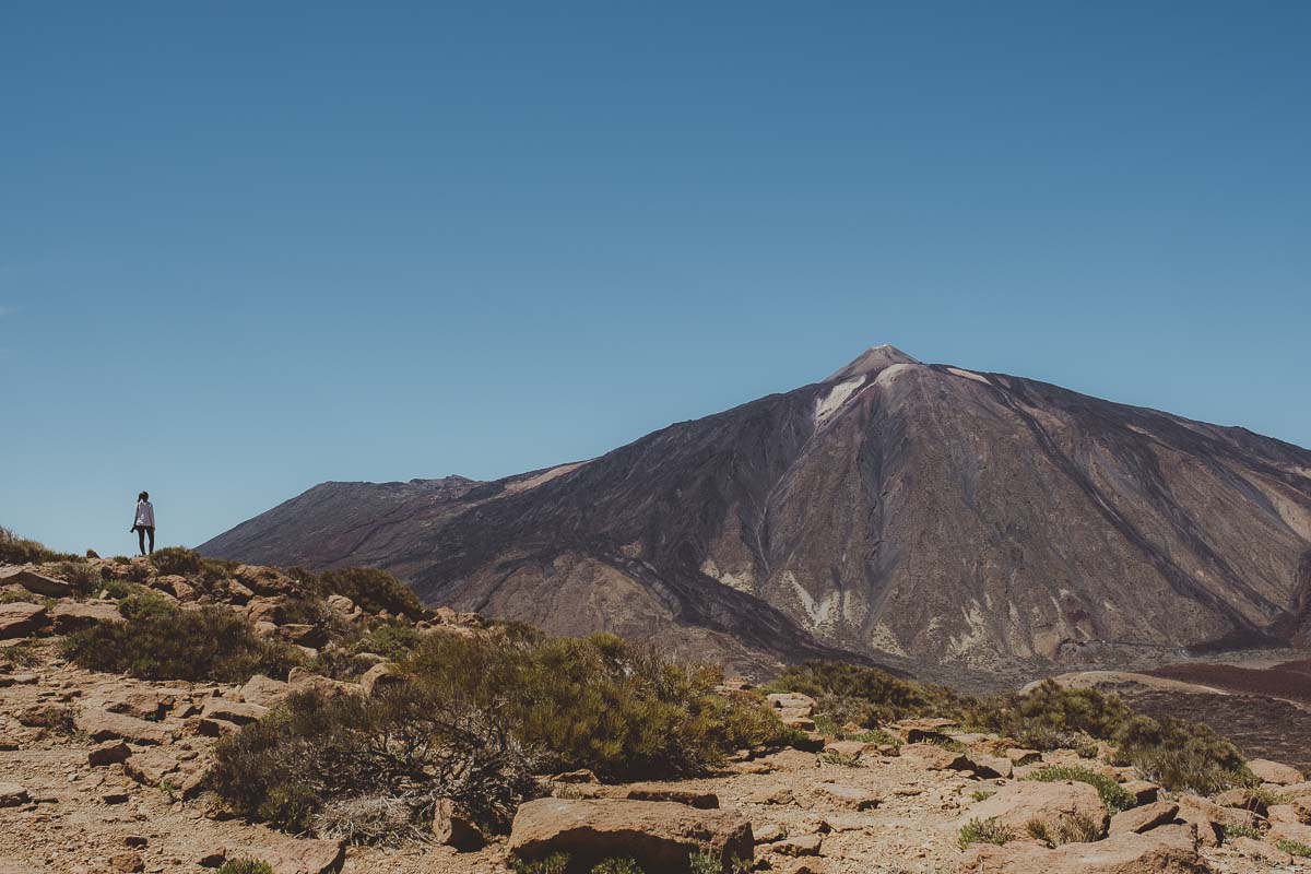
Center: All about the Teide, the highest mountain in Spain. The Teide volcano is in the center of the island and the Teide National Park has lots of options for hiking, rock climbing, and viewpoints to enjoy the different views of Teide.
WHAT TO DO IN THE SOUTH OF TENERIFE
I call the South the section between Los Gigantes all the way to Santa Cruz de Tenerife. The entire coast is dotted with beach towns and resorts, this is where mass tourism is at its highest, as it has the best weather on the island. But don’t worry, it’s not all resorts! there are also very cool activities to do in this area:
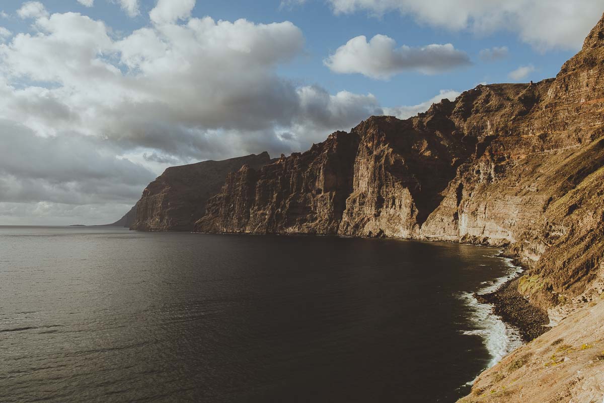
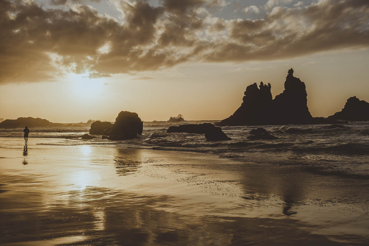
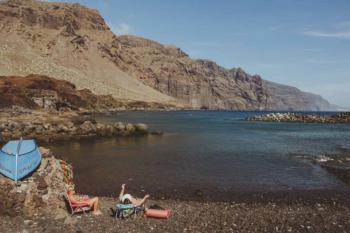
- Los Acantilados de los Gigantes is a simply stunning place. Its 600 meter high cliffs resting in the water are amazing. There are different ways of seeing them. From Puerto de Santiago, you can find several viewpoints scattered around the area. In addition, from playa de Los Guíos, a black sand beach, the views are spectacular. There is also the option of taking a boat excursion to see them from the water. In addition, in this part of the island, the marine life is very active and it is one of the best places to go whale and dolphin watching or to go diving.
- Diving in Tenerife was definitely at the very top of things I wanted to do on the island. We went diving with the guys from Biosean and the experience was wonderful. They took us to 2 dive sites where we could see turtles, rays, stingrays, and lots of marine life. I highly recommend them!
- Dolphin watching was another activity that had the highest priority during the trip. We did a Kayak excursion with Xplore Tenerife and I loved the experience. We chose to go by kayak and not by boat because we know that the dolphins are bothered by the noise of the engines and we didn’t want to disturb them with our presence. As a result, we were able to see dolphins very close, curiously approaching our kayak and jumping next to us without any fear. It was totally amazing, I definitely recommend it!
- Montaña Amarilla is a place with an interesting landscape of volcanic rock formations. A great place to dive or snorkel as there is lots of marine life.
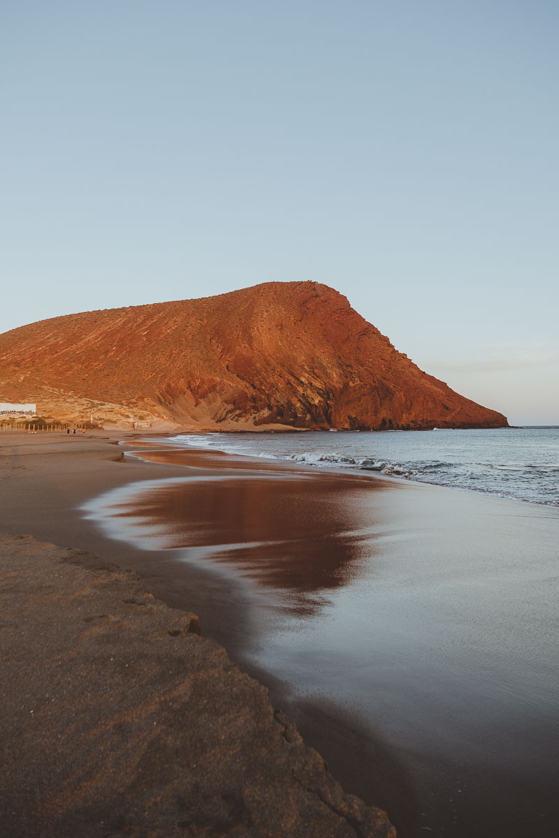
- Montaña Roja – Playa de la Tejita is the ideal place to watch the sunset, as the mountain lights up in a spectacular red color. There is a path to go up to the top where the view is great.
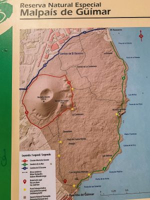
- El puertito de Güímar there is a path through the volcanic landscape of Reserva Natural de Malpaís that seems from another planet. It is a hike through a terrain of black lava mixed with red sand right next to the seashore.
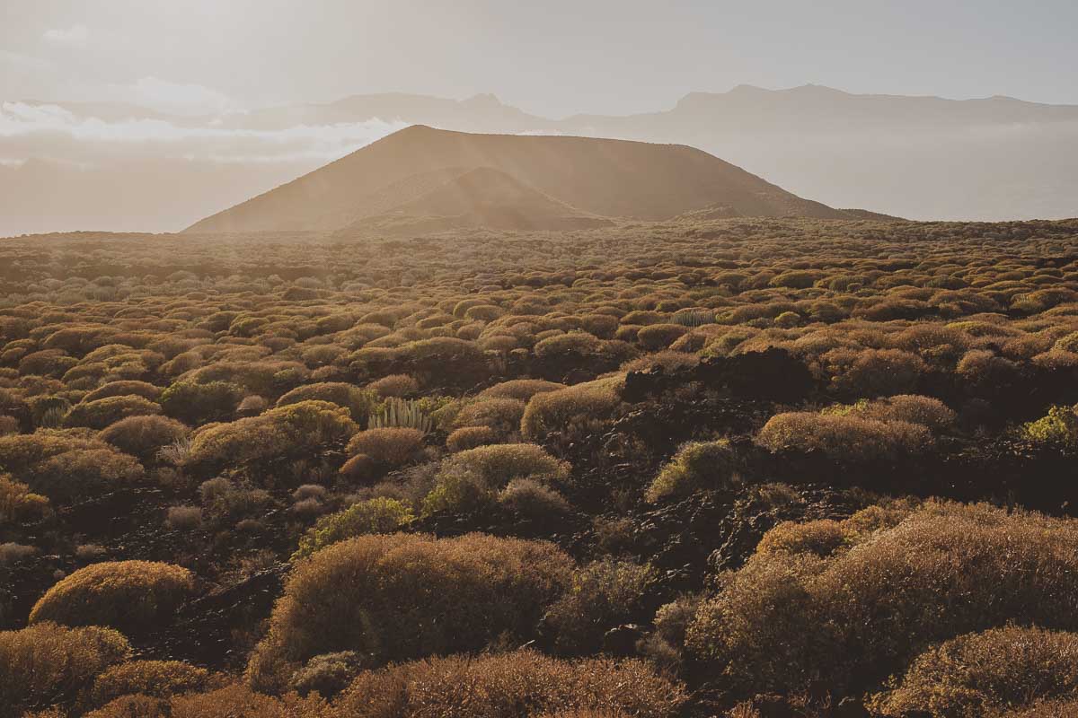
It is a circular route, we start the hike from el Puertito de Güímar, not along the coast but inland, to see all the vegetation in the area, in the direction of Montaña Grande. Then the path joins the one that takes us to the coast and we return walking along the water, crossing the volcanic landscape. It’s a very nice 2-hour hike.
- Candelaria: I found it to be the most interesting town on this side of the island. A traditional coastal town with a cathedral to the Virgin of Candelaria, the patron saint of the Canaries.
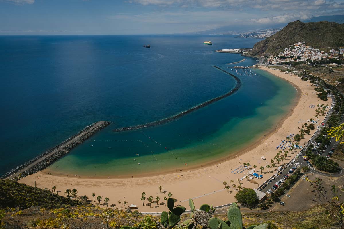
- Las Teresitas is one of the most famous beaches in Tenerife. It is the only one that has white sand, and it is also huge and full of palm trees. It is the typical postcard paradise beach. Very different from the black beaches of the rest of the island. It is worth coming here with enough time to enjoy a relaxing time.
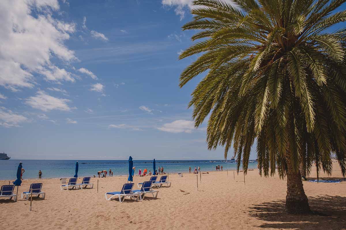
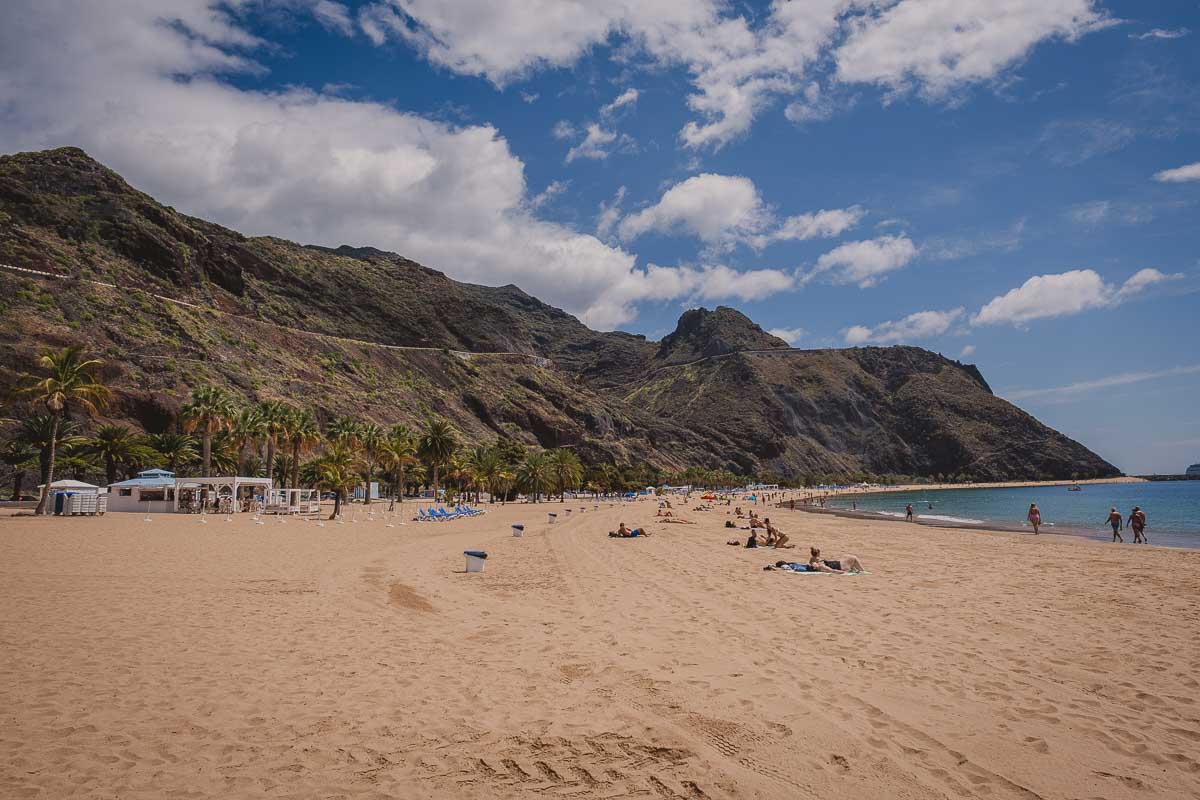
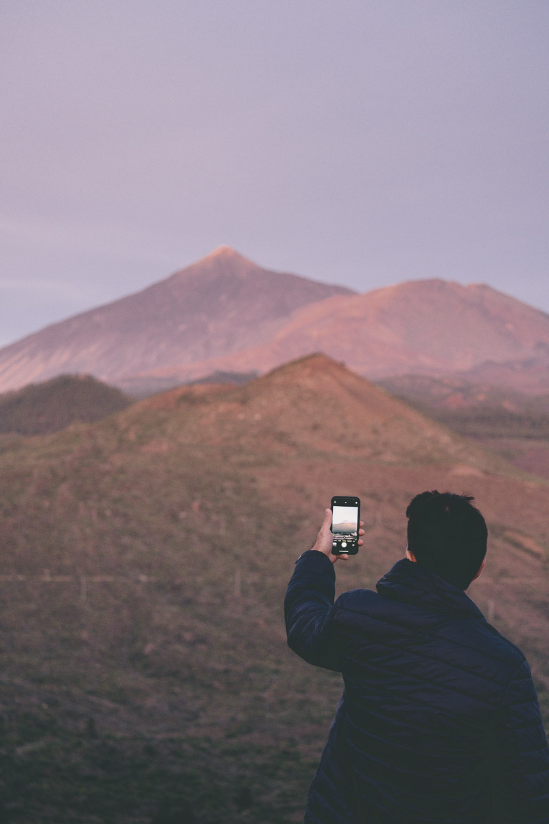
- The viewpoint of las Teresitas: This is the most emblematic image of Tenerife, the view of Las Teresitas beach from the viewpoint. With the car, it is only a few minutes uphill (and curves) on the road to the north.
EASTERN POINT – ANAGA RURAL PARK
The Anaga Rural Park covers the entire eastern end of the island. It is huge and has many things to do. Here is the itinerary we followed along viewpoints and hikes:
- We started off at the viewpoint Mirador de Jardina from where you can see the Teide (on a clear day) and the town of Jardina
- Then we went to Mirador Zapata or Mirador Batán, another good viewpoint to see Teide and its surroundings.
- Next stop: Mirador de Cruz del Carmen, here is where the visitor center is located and you can receive all the hiking recommendations. There are many trails starting from here. It is better to arrive early because the parking lot, although it is big, fills up quickly, and waiting for a car to leave can take a long time. The viewpoint also has very good views.
- We chose to do the trail called “el Sendero de los Sentidos” or the path of the senses, it is short, interesting, and in the heart of the laurel forests
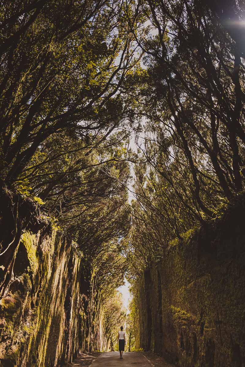
- Then we head towards the Pico del Inglés viewpoint, but we made a stop 500 meters before arriving to see the old road to Pico del Inglés, here is the exact location. It is a small corridor between the forest, where a kind of tunnel is created between the trees. It is very beautiful and photogenic
- Viewpoint Mirador Pico del Inglés – spectacular views of the island
- Viewpoint Mirador “Risco Amogoje” – another spectacular viewpoint on the way to Taganana
- We headed towards Taganana, a small town within the Anaga Rural Park. It is worth taking a little walk through its streets, but what’s most interesting is the beautiful view of layers of pointy mountains next to the sea.
- We drove along the coastal road, we passed through Almaciga and arrived at Benijo to do the Benijo-Cruz del Draguillo – El Draguillo – Benijo hike. It was a tough one, I recommend going with time and energy. It tooks us 2 hours and 90% of our energy.
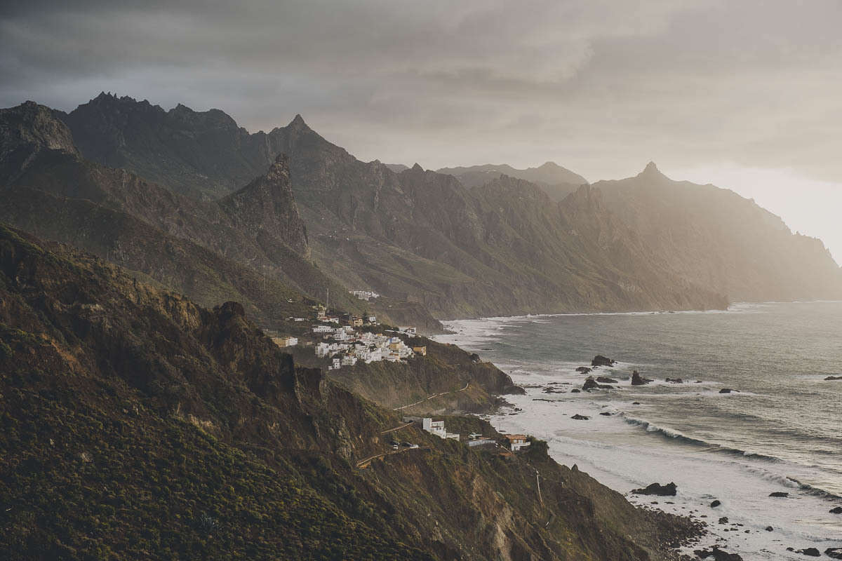
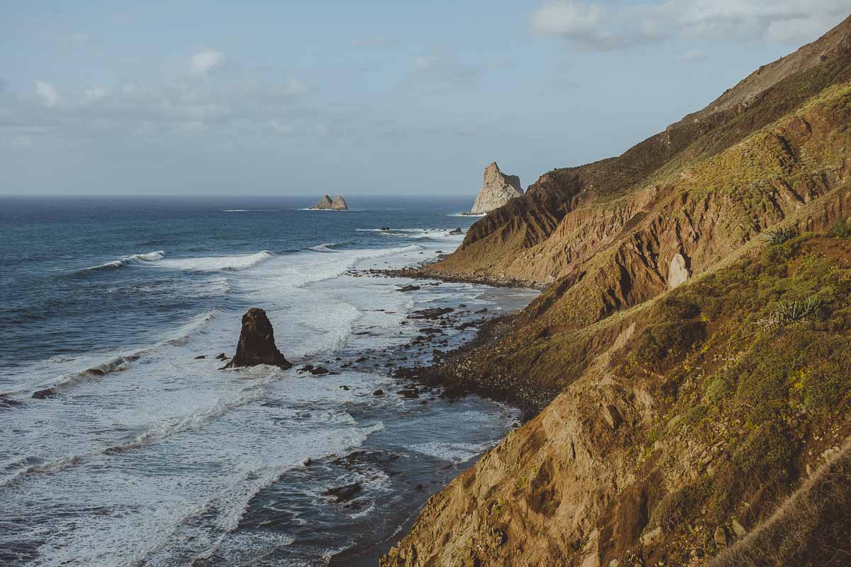
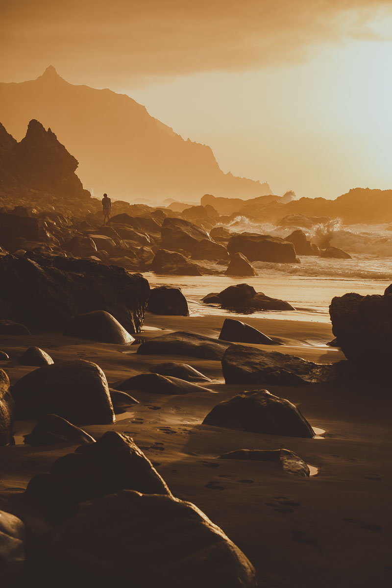
- This day ended with us exhausted watching the sunset at Playa de Benijo, which is one of the island’s must-sees. The black volcanic sand, the rocks that adorn the landscape, and the mountain peaks that surround it, make Benijo one of the most spectacular beaches on the island. It is not ideal for bathing, because the currents are very strong and can be dangerous, but it is one of the best places on the island to watch the sunset. Highly recommended!
As you can see, in one day you can visit a large part of the Anaga rural park, but if you have time to spend one more day, do not miss these places:
- Afur
- Las Carboneras
- Chinamada
- Punta de Hidalgo
- Bajamar
You can spend days and even weeks in this rural park doing lots of hiking through the mountains. For lovers of hiking and beautiful landscapes, this is paradise.
WHAT TO DO ON THE NORTH OF TENERIFE
- San Cristóbal de La Laguna – The little jewel of the island, a world heritage site, and the first city in the Canary Islands. Colonial architecture, historic streets, churches and convents, colorful houses, squares surrounded by palm trees. In this city, we started to see more of how the locals live, it has a more local atmosphere than what we had been seeing in southern cities. Here we were able to finally find real local food!
- La Orotava is one of the oldest towns on the island, and as such, it is full of history and charm. The old town is a beauty with its colorful houses and old balconies, and on a clear day, you can see Mount Teide in the background. I loved this little town!
- Puerto de la Cruz – The main city in the north of the island, with a charming historic center where you can appreciate the Canarian culture and a promenade to enjoy the coast, the beaches, and the views. Here you can also visit the pools of Lago Martiánez, designed by César Manrique.
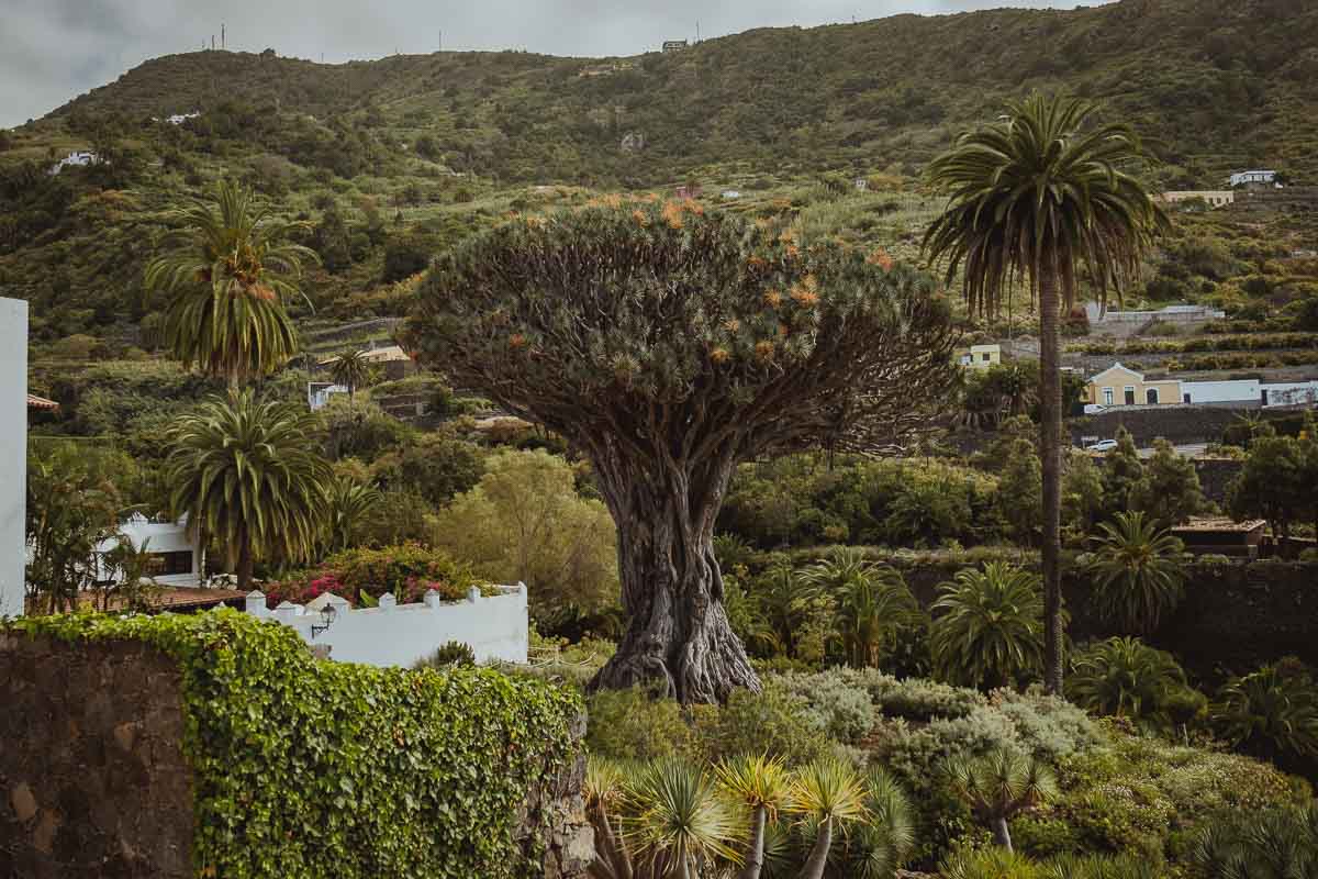
- Icod de los Vinos is another charming little town full of history, culture, and also wine. There’s a beautiful historic center where you can take a walk and see the famous Drago Milenario, a huge unique plant species from the Canary Islands, whose age is estimated at about 800 years (!). You can pay admission to see it up close, or you can see it from San Marcos Square.
- Garachico is a town full of history (it was the first port of Tenerife in the 15th century), which can be felt when walking through its beautiful old town. Important note, bring a towel and bathing suit to enjoy the natural pools, they are so good!
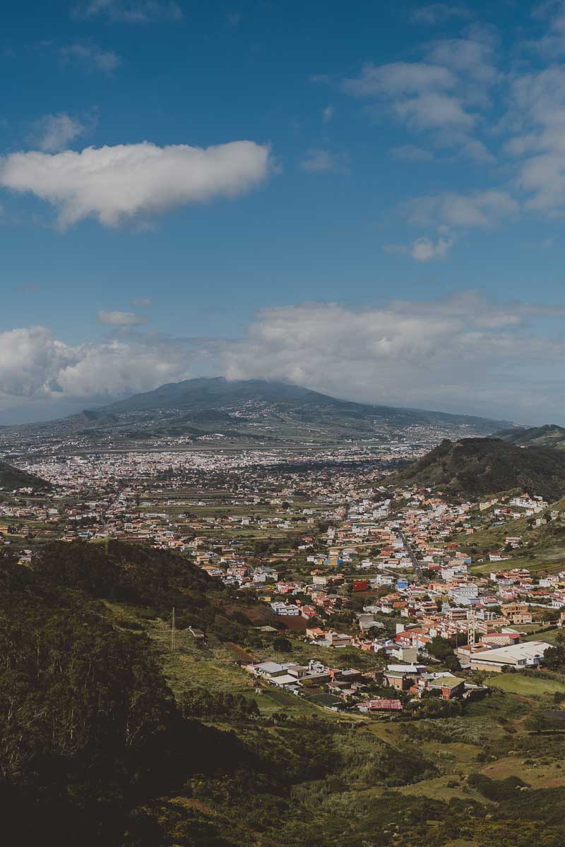
The landscape in the north of the island is very different from that in the south. It is much greener, mountainous and rugged, so the roads are more difficult to drive, but the views going between towns are spectacular! I recommend going slowly and stopping at all the viewpoints along the way. Being more humid and mountainous, the weather is cooler, cloudy and sometimes foggy.
WESTERN POINT – TENO RURAL PARK
The western tip of Tenerife is covered by the Teno Rural Park, a mountainous massif surrounded by the sea. This means that it has many hiking options, many viewpoints and spectacular landscapes. The park’s visitor center is in the town of El Palmar, here.
A continuación les cuento la ruta que hicimos para visitar el parque:
- The first stop was Buenavista del Norte – To go to Punta del Teno it is necessary to take bus 369 that leaves from the guaguas station. The road to la Punta is restricted and private cars cannot access it during certain hours. More info about restrictions and schedules here. You can see the bus schedules here. Although on this page it says that you can only pay with a TEN+ monedero card, when we were there they were also accepting payments with a contactless bank card.
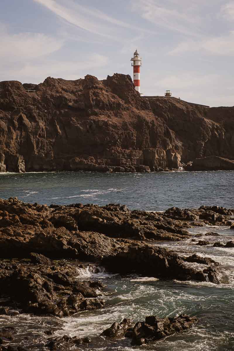
- Punta del Teno – We took the bus to Punta del Teno, which is a beautiful and very quiet place to spend the afternoon, you can swim on the beach, take small walks and enjoy the landscape. It has a very photogenic lighthouse.
- We went back on the last bus of the day to Buenavista del Norte and the next day we started our way across the park, stopping at some viewpoints:
- Viewpoint Mirador Altos de Baracán has amazing views. Plus, from here you can find a hiking trail that goes through Teno Alto and reaches Punta del Teno. This is an alternative to going by bus to Punta del Teno if you have the time.
- Mirador La Cruz de Hilda – Another viewpoint with impressive views and a restaurant to enjoy the landscape while eating delicious food!
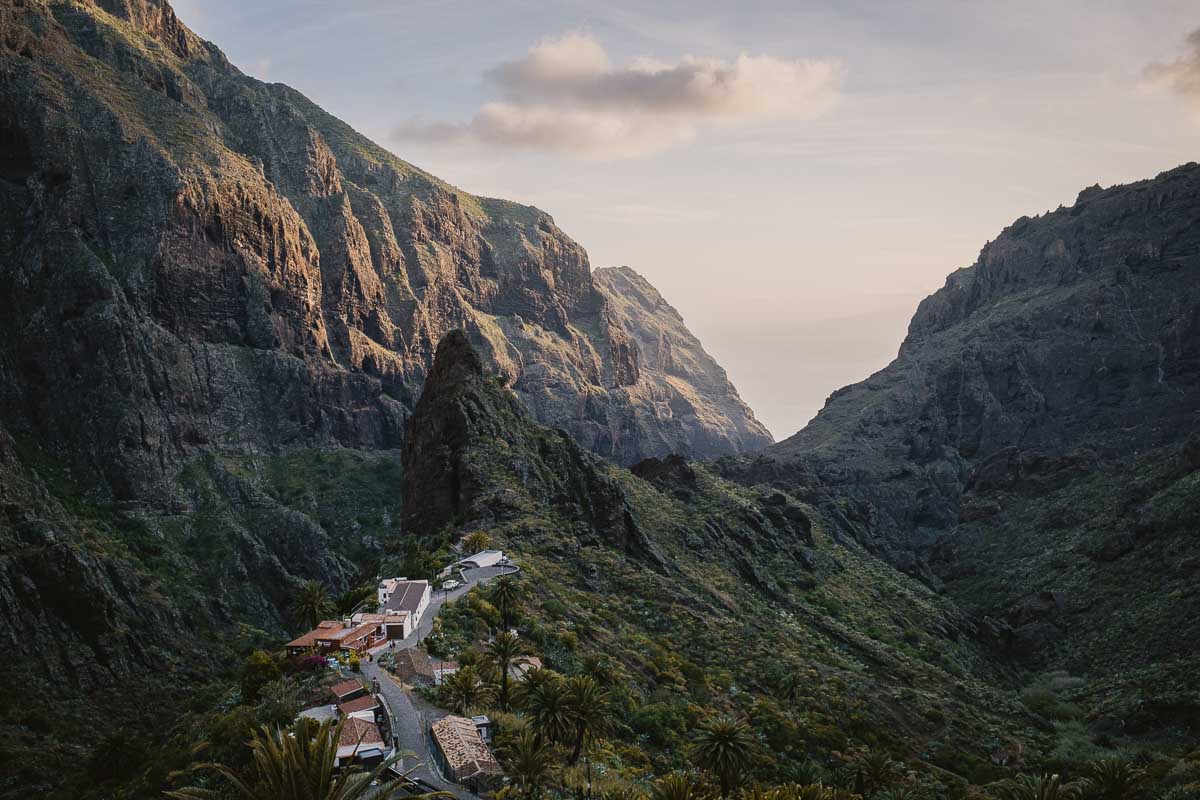
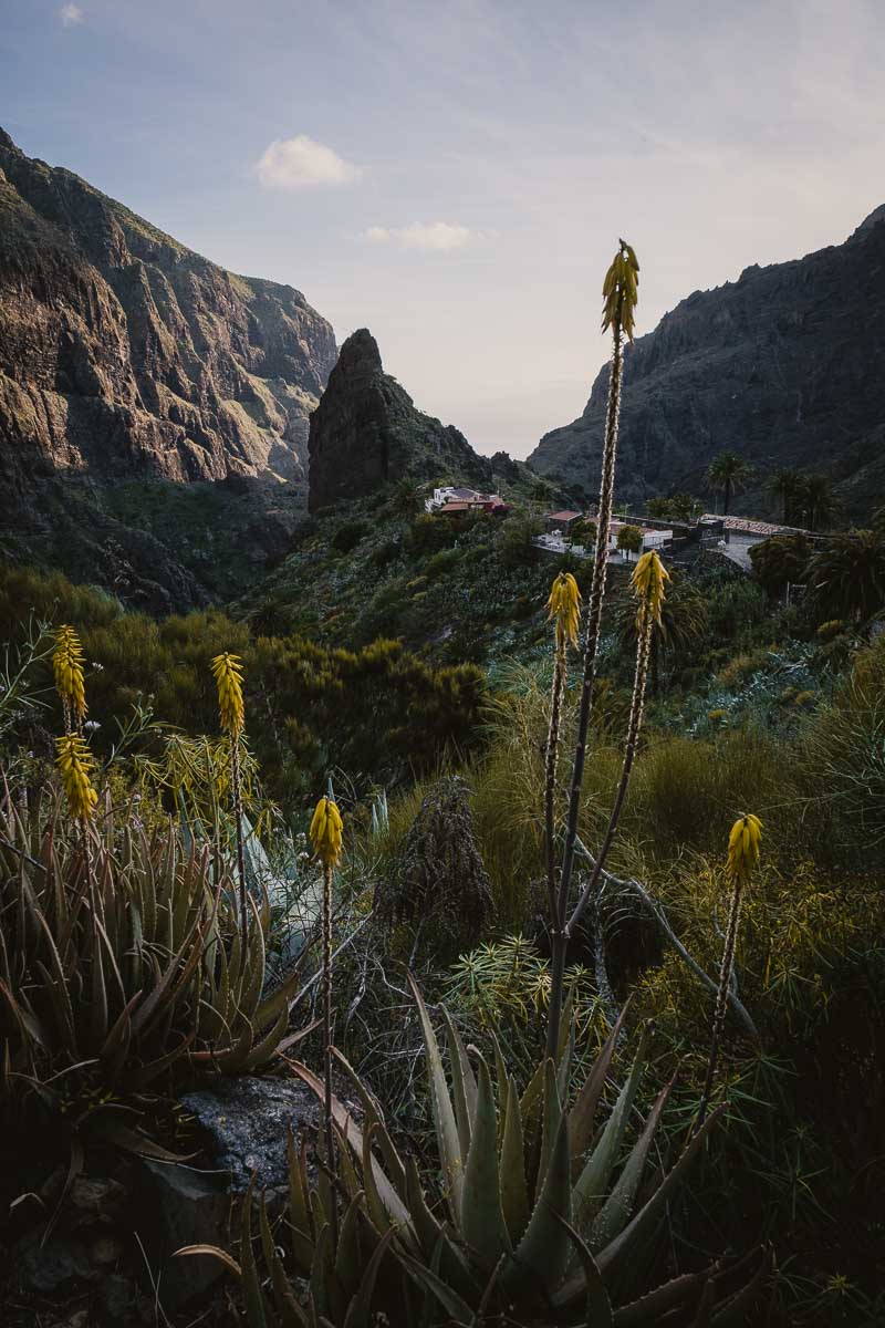
- Masca – Another gem of the island. They call it the Machu Pichu of Tenerife because of its shape. It is a tiny town in the middle of the mountains of the Teno park. It has a lot of history since it was a Guanche settlement there in the 15th century. Definitely a must-see! The road is a bit complicated, it is narrow and with many curves, so it is better to drive with caution. Lots of hiking trails can be found from Masca. There is even a hike that crosses the Masca ravine and ends at the beach.
- Mirador de Cherfe – Following the road for a few minutes, from Masca in the direction of Santiago del Teide, you can find one of the coolest viewpoints. From here you can not only appreciate the beauty of the Teno mountains but there is also a very nice postcard view of Teide.
- Mirador del Teide – Since we became such a big fans of Teide, we ended the day at this viewpoint that, as its name indicates, has beautiful views of the volcano.
Another very long day (especially for the driver) but very satisfying. This little island has landscapes that leave you speechless.
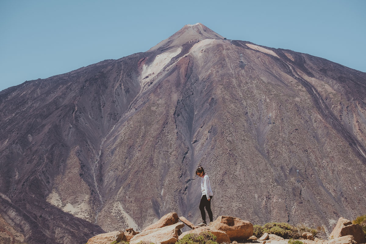
CENTER OF THE ISLAND – TEIDE AND ITS VIEWPOINTS
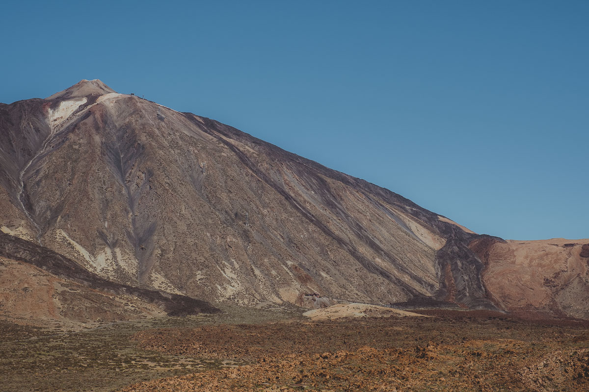
This section is dedicated to everything related to Mount Teide, the highest point in Spain and the third highest volcano in the world (!)
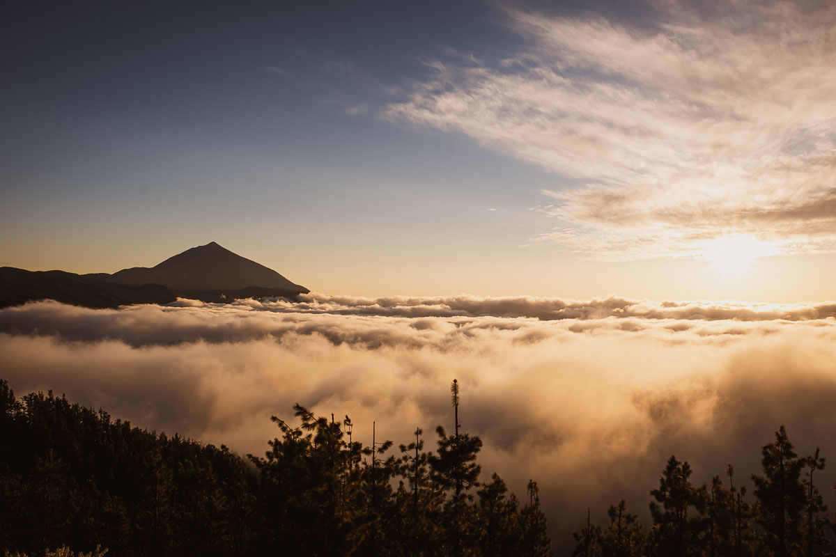
- Mirador de Chipeque – It is not exactly within the Teide National Park, but it has one of the most beautiful views of the volcano. They call it the sea of clouds because towards the afternoon the clouds roll in and the tip of the volcano peaks through the clouds, creating a beautiful image. The recommendation is to go at sunset. Clouds and fog move fast, so if you arrive and the volcano is covered by clouds, be patient, at some point it can clear, even if just for a few minutes.
- Teide National Park – It has a lot of trails to explore on foot of different types of difficulty. I recommend visiting the El Portillo visitor center to choose the one that suits you best. You can also go rock climbing here if that’s your thing.
- How to climb Mount Teide – You need to get a permit to get to the very tip of Teide. Whether you go up by cable car or on foot, if you want to cross the last part of the trail that leads to the point (the last 800 meters on the Telesforo Bravo trail) after 9 am, you need a permit, which you can get here. The recommendation is to get it as far in advance as possible, at least a month, or more since there are few permits per day and they run out quickly. If you cannot get the permit, you can still go up the Teide, but you cannot reach the very top.
- There are several options to climb Mount Teide:
- by cable car – You can drive to the base of Teide at 2,356 meters and go up by cable car at 3,555 mts. The last section to the top must be done on foot, for around 800 meters. It is a difficult path, due to the altitude and the lack of oxygen. For this last section, you need a permit.
- by foot during the day – you can also walk up and down, which would take about 10 hours. The difficulty of the trail is very high, so experience in high mountain trails and appropriate gear is a must. The temperature can drop dramatically close to the top. You need to follow the trail called Montaña Blanca.
- by foot, starting in the afternoon, sleeping on the mountain, and watching the sunrise at the top – another option is to split the walk into two parts: starting to climb in the afternoon and spending the night in the Altavista refuge (closed during the pandemic). This way you don’t need a permit to access the top, because sunrise is before 9 am and the permit is necessary after 9 am. This alternative is very interesting because the sunrise at the top of Teide is an unforgettable experience. Reservations for the refuge should be made well in advance as well. The ascent can take between 4 and 5 hours (or more), as well as the descent.
- hike at night to reach the top at dawn – another alternative in which you don’t need a reservation at the refuge or a permit the access to the top is to make the climb at night to reach the top at sunrise. It is definitely the most difficult option, so you have to be very cautious and experienced to do something like that. Keep in mind that you need at least 5 hours or more to reach the top, the winds are strong and very cold!
- One option that we discarded was to go up by cable car and walk down, or walk up and down by cable car, simply because the parking lot of the white mountain trail is far from the cable car parking lot, so logistically we would not know what to do with the car…
- Guajara – The Guajara mountain is, after Teide, the highest on the island. Climbing to the summit is a bit difficult, but the views are truly amazing because during the whole hike we have Teide right next to us. You can get to the base of the trail by car at the Cañadas del Teide Parador and from there you’ll find several trails.
We did a 5-hour circular trail that took us to the summit and then back to the parking lot: First we took trail 4, at the first crossing we took trail 31, then trail 15 to Alto de Guajara that took us to the summit, and part of the way back, it joined trail 5 and to finish we took trail 4 that took us to the Parador. It can seem very confusing on paper, but when you are there everything is very well marked and the trails are easy to follow. This hike is difficult, it is recommended to bring food and a lot of water, as well as good hiking clothes since it can be very windy along the way and the sun is quite strong.
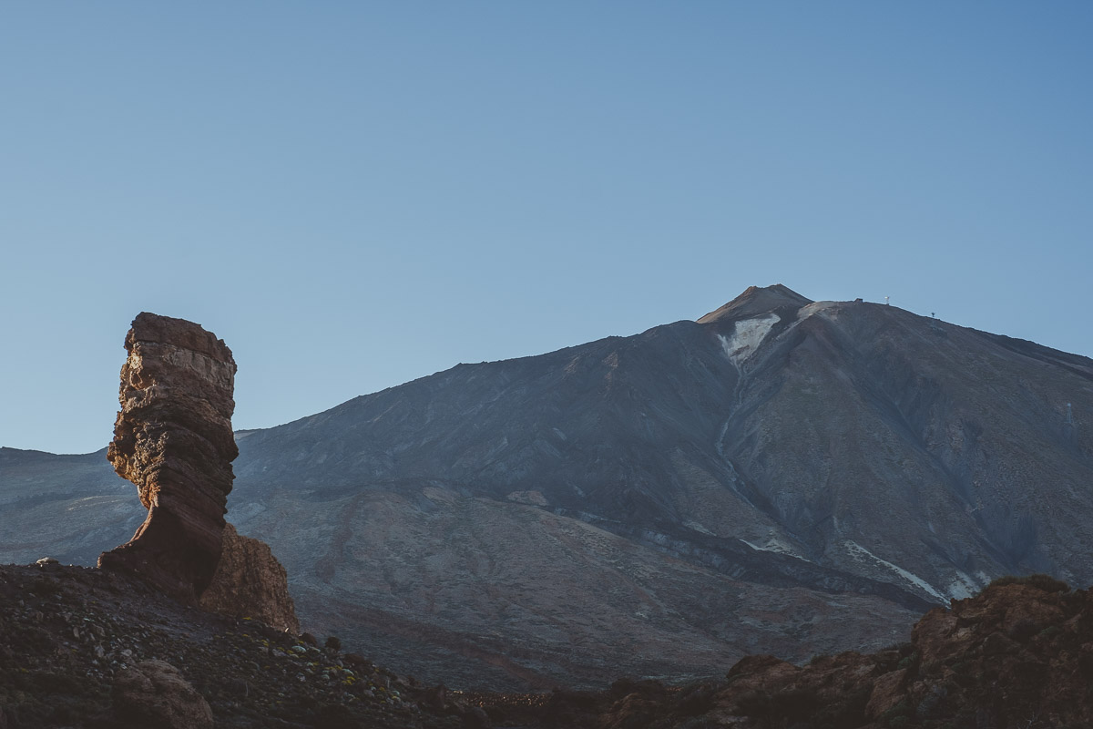
- El roque Cinchado – It is a very popular volcanic rock due to its peculiar shape with Mount Teide in the background. It was the image of the 1000 pesetas banknote.
SOME ADDITIONAL TIPS
- Be careful in parking lots, do not leave anything inside the car. Unfortunately, thefts are very common. We often saw broken glass from windows on the floor of many parking lots.
- You could consider splitting the trip into two parts and staying half the time in a hotel in the north and half of the time in the south, that way you won’t have to drive as much.
- Car rental with CICAR is ridiculously cheap and the cars are in great condition.
Save this image to your Pinterest so you don’t lose it when planning your trip.
See you on the next trip!